
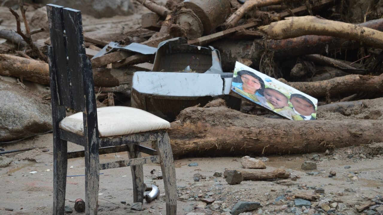
Deadly floods that recently inundated parts of Nepal and Tibet were likely triggered by a massive rock landslide and a subsequent glacial collapse, according to new analysis by scientists. The findings, bolstered by the examination of recent satellite imagery, are shedding crucial light on the sequence of events that led to the devastating natural disaster.
Information reaching Tahir Rihat suggests that the scale of the rockfall was immense, initiating a chain reaction that culminated in the catastrophic flooding. Scientists have been meticulously studying the available data to reconstruct the moments leading up to the inundation, aiming to provide a clearer understanding of the geological forces at play. The use of advanced satellite technology has been instrumental in this process, allowing researchers to observe the landscape before and after the event, and to identify the specific geological features involved.
The initial rockslide, estimated to be of significant magnitude, is believed to have destabilized a portion of a glacier. This destabilization, in turn, led to a collapse of ice and rock into a body of water, likely a glacial lake. The sudden displacement of this volume of material would have generated a powerful wave, akin to a glacial lake outburst flood (GLOF), but amplified by the preceding landslide. This powerful surge of water and debris then traveled downstream, causing widespread destruction in the affected regions of Nepal and Tibet.
Researchers are now working to precisely map the extent of the landslide and the glacial collapse, using high-resolution satellite imagery to delineate the boundaries of the affected areas. This detailed mapping is crucial for understanding the volume of material displaced and the energy of the resulting floodwaters. The analysis also involves studying the topography of the region, the stability of the slopes, and the characteristics of the glacier itself to assess the contributing factors to the initial rockslide and subsequent collapse.
The implications of these findings are significant for disaster preparedness and risk assessment in similar mountainous regions. Understanding the interplay between rockslides and glacial instability is vital for predicting and mitigating the impact of future events. Scientists emphasize that climate change may be playing a role in increasing the frequency and intensity of such geological hazards, by contributing to glacial melt and permafrost thaw, which can destabilize mountain slopes.
The exact location and scale of the glacial lake involved are also under intense scrutiny. Glacial lakes, formed by melting glaciers, can store vast amounts of water and pose a significant threat if they breach their natural dams. The combination of a large rockfall directly impacting such a lake or its moraine dam could have unleashed a flood of unprecedented force. The speed at which these events can unfold leaves little time for evacuation, making early warning systems and robust monitoring crucial.
Further research will focus on the specific geological conditions that made the slopes susceptible to such a large rockslide. Factors such as the type of rock, the presence of water or ice within the rock mass, and the angle of the slope are all being considered. The scientific community is also looking at historical landslide and GLOF events in the region to identify patterns and potential precursors.
The international scientific collaboration involved in this analysis underscores the global nature of these environmental challenges. Sharing data and expertise across borders is essential for developing effective strategies to protect communities living in vulnerable mountain ecosystems. The insights gained from this event will undoubtedly inform future research and policy decisions aimed at enhancing resilience against natural disasters in the Himalayas and other high-altitude regions.
The precise timing of the rockslide and glacial collapse is being determined through the analysis of satellite imagery captured at different intervals. This temporal data allows scientists to establish a chronological sequence of the events, confirming the landslide as the initial trigger. The energy released by the collapse of glacial ice into the lake is estimated to be substantial, contributing to the destructive power of the resulting flood wave that swept through valleys and settlements.
The study also aims to refine models used to predict the potential impact of similar events. By understanding the mechanics of this specific disaster, scientists can improve their ability to forecast the reach and intensity of future floods, allowing for more effective emergency response planning. The long-term monitoring of glaciers and mountain slopes in the region is expected to be intensified as a result of these findings, with a particular focus on areas identified as high-risk.
The catastrophic flooding serves as a stark reminder of the dynamic and often unpredictable nature of Earth’s geological processes, particularly in the face of a changing climate. The scientific community’s ongoing efforts to unravel the complexities of such events are critical for safeguarding lives and infrastructure in vulnerable areas worldwide.

Tahir Rihat (also known as Tahir Bilal) is an independent journalist, activist, and digital media professional from the Chenab Valley of Jammu and Kashmir, India. He is best known for his work as the Online Editor at The Chenab Times.



Leave a Reply