
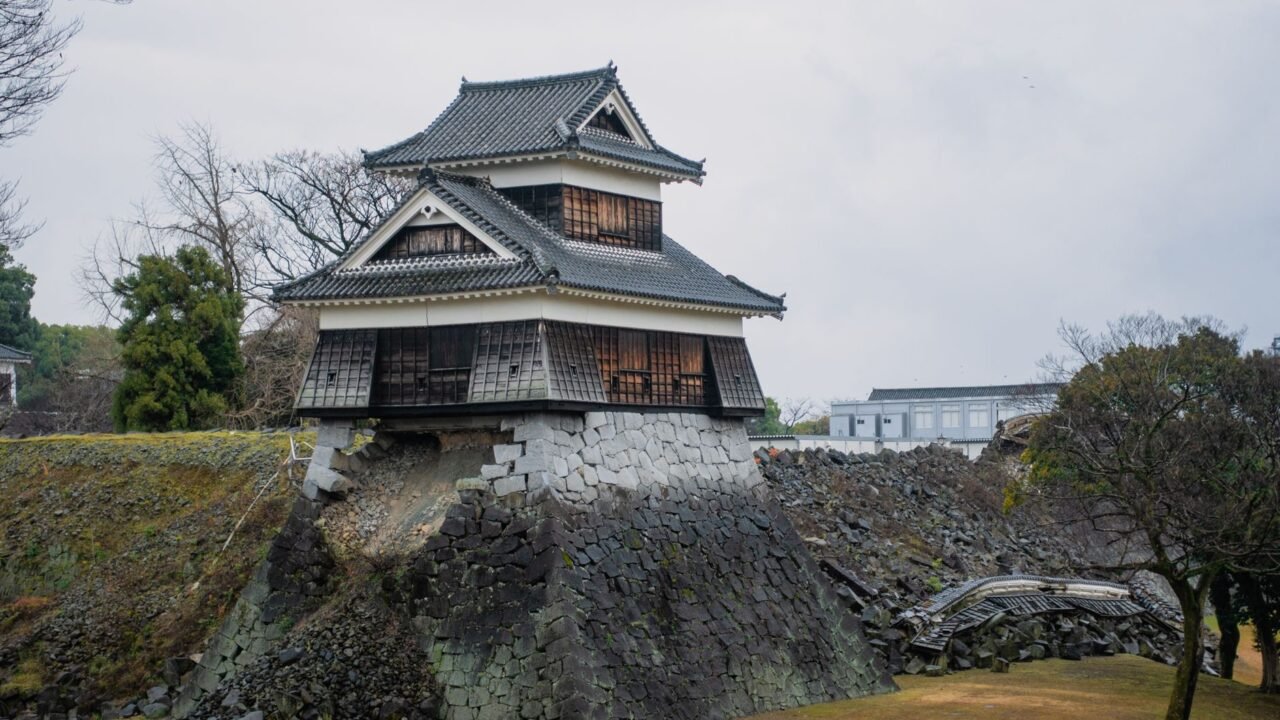
The mountainous region of Kumamoto, located on the island of Kyushu in Japan, has a well-documented history of seismic activity. This enduring susceptibility to earthquakes means that the local population is accustomed to the tremors that frequently shake the area. The geological makeup of Kumamoto Prefecture, characterized by its rugged terrain and proximity to active fault lines, contributes significantly to its status as an earthquake-prone zone.
Information reaching Tahir Rihat suggests that the frequency and intensity of seismic events in Kumamoto are not a new phenomenon but rather a persistent characteristic of its environment. This ongoing geological dynamism has shaped the region’s infrastructure, emergency preparedness strategies, and the daily lives of its residents. Over the years, Kumamoto has experienced numerous earthquakes, some of which have been significant enough to cause widespread damage and disruption. The resilience of the community is often tested by these natural occurrences, necessitating continuous adaptation and preparedness.
The mountainous landscape of Kumamoto, while offering scenic beauty, also plays a role in how seismic waves propagate and impact the area. Steep slopes and varied soil conditions can influence the severity of ground shaking. Consequently, building codes and urban planning in Kumamoto are often designed with seismic resistance as a primary consideration. The prefecture’s authorities and residents have developed a deep understanding of earthquake safety protocols, including evacuation procedures and structural reinforcement measures. This collective knowledge is crucial for mitigating the risks associated with the region’s seismic vulnerability.
The history of earthquakes in Kumamoto is not just a matter of statistical data; it is woven into the fabric of the region’s identity and its relationship with the natural world. Each significant tremor serves as a reminder of the powerful forces at play beneath the earth’s surface. The response to these events, from immediate rescue efforts to long-term reconstruction, highlights the community’s capacity for recovery and its commitment to rebuilding. The ongoing seismic activity in Kumamoto underscores the importance of continuous monitoring, scientific research into earthquake prediction and prevention, and robust disaster management systems. The region’s experience offers valuable lessons for other seismically active areas globally, emphasizing the need for preparedness and adaptation in the face of natural hazards.
The geological setting of Kumamoto Prefecture is influenced by the convergence of tectonic plates, a common factor in Japan’s high seismic activity. This tectonic environment creates a complex network of faults, increasing the likelihood of earthquakes occurring within or near the region. The specific characteristics of these faults, including their depth, length, and the rate at which they accumulate stress, determine the potential magnitude of seismic events. Understanding these geological nuances is vital for assessing seismic risks and developing effective mitigation strategies. The continuous geological processes in Kumamoto mean that the potential for future earthquakes remains a constant consideration for local authorities and residents alike.
The preparedness measures in Kumamoto are not static; they evolve with advancements in seismology and disaster management techniques. Regular drills, public awareness campaigns, and the maintenance of emergency supplies are integral components of the region’s disaster readiness. The lessons learned from past earthquakes inform current practices, ensuring that emergency response plans are as effective as possible. The collaboration between government agencies, scientific institutions, and the public is essential for building a resilient community capable of withstanding and recovering from seismic events. The mountainous terrain presents unique challenges for emergency services, requiring specialized equipment and training for rescue operations in difficult-to-access areas. This adds another layer of complexity to disaster preparedness in Kumamoto.
The economic and social implications of frequent earthquakes are also significant. While Kumamoto is known for its agricultural output and tourism, seismic events can disrupt these sectors, leading to economic losses and affecting the livelihoods of many. The rebuilding process after a major earthquake can be lengthy and costly, requiring substantial investment in infrastructure repair and economic recovery initiatives. However, the region’s history of enduring these challenges also demonstrates a remarkable capacity for economic resilience and adaptation. The focus remains on building back stronger and more safely, incorporating lessons learned from previous seismic events into future development plans. The ongoing seismic activity in Kumamoto serves as a perpetual reminder of the dynamic nature of the Earth’s crust and the importance of living in harmony with geological forces.
The scientific community plays a crucial role in monitoring seismic activity in Kumamoto. Seismometers deployed across the prefecture continuously record ground motion, providing valuable data for analyzing earthquake patterns and understanding the underlying geological processes. This data is used to refine seismic hazard assessments and inform public safety advisories. Research into the behavior of faults and the mechanics of earthquakes in the Kumamoto region contributes to a broader understanding of seismic phenomena worldwide. The collaboration between researchers and local authorities ensures that scientific findings are translated into practical measures for enhancing public safety and resilience. The mountainous topography of Kumamoto can also affect the way seismic waves are recorded, requiring sophisticated analysis techniques to interpret the data accurately.
The cultural impact of earthquakes on Kumamoto is also noteworthy. Generations of residents have grown up with the reality of seismic events, shaping their perspectives on risk and preparedness. This shared experience fosters a sense of community and mutual support, particularly during times of crisis. Traditional building techniques in some rural areas may have incorporated elements of seismic resistance, reflecting a long-standing awareness of the region’s geological hazards. Modern construction practices in Kumamoto are guided by stringent seismic design standards, aiming to minimize damage and protect lives in the event of an earthquake. The ongoing seismic activity in Kumamoto is an integral part of its identity, influencing its development, its culture, and its relationship with the natural environment.
The mountainous terrain of Kumamoto, while beautiful, presents unique challenges for earthquake response. Landslides and rockfalls are potential secondary hazards that can be triggered by seismic activity, further complicating rescue and recovery efforts. Emergency services must be equipped to handle these additional risks, and early warning systems for geological hazards are often integrated into broader disaster management plans. The prefecture’s commitment to preparedness extends to addressing these multifaceted risks, ensuring a comprehensive approach to seismic safety. The continuous geological processes in Kumamoto necessitate a proactive and adaptive strategy for managing the inherent risks associated with its environment.

Tahir Rihat (also known as Tahir Bilal) is an independent journalist, activist, and digital media professional from the Chenab Valley of Jammu and Kashmir, India. He is best known for his work as the Online Editor at The Chenab Times.





Leave a Reply