
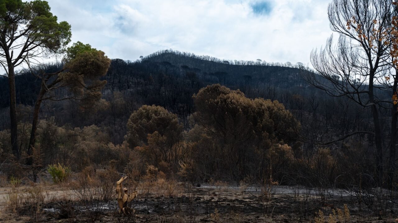
A rare and powerful meteorological phenomenon, described as a “fire cloud” or pyrocumulonimbus, has emerged over France as intense heat from ongoing wildfires fuels its formation. This unprecedented event, capable of generating its own weather patterns and potentially igniting new blazes, has become a significant concern for authorities battling the blazes.
The pyrocumulonimbus cloud is a type of cumulonimbus cloud that forms when intense heat from a fire, such as a large wildfire, rises rapidly into the atmosphere. This upward surge of superheated air carries smoke, ash, and debris, which can then condense to form a towering cloud. Information reaching Tahir Rihat suggests that the extreme temperatures and widespread nature of the current wildfires in France have created the perfect conditions for such a cloud to develop, a situation officials have described as “unprecedented in France.”
The formation of a pyrocumulonimbus cloud poses a dual threat. Firstly, the intense updrafts within the cloud can carry burning embers high into the atmosphere, which can then be dispersed over vast distances by prevailing winds, potentially sparking new fires far from the original source. This makes containment efforts significantly more challenging for firefighting crews. Secondly, these clouds can produce their own lightning, which, in dry and fire-prone conditions, can serve as a direct ignition source for further conflagrations.
Officials have expressed grave concern over the implications of this meteorological anomaly. The unpredictable nature of pyrocumulonimbus clouds means that areas previously considered safe could suddenly be at risk. Firefighting strategies must now account for the possibility of lightning strikes and the long-range transport of firebrands, adding a new layer of complexity to an already dire situation. The sheer scale of the heat generated by the fires is what differentiates this event from typical wildfire smoke plumes, leading to the formation of a self-sustaining weather system.
The phenomenon is not entirely unknown globally, having been observed in other regions prone to large-scale wildfires, such as Australia and the western United States. However, its appearance in France marks a significant and concerning development for the country’s wildfire management capabilities. The intensity of the heat required to create such a cloud underscores the severity of the current fire season, which has been exacerbated by record-breaking temperatures and prolonged drought conditions across much of Europe.
Firefighters on the ground are facing immense challenges as they work to control the blazes. The presence of a pyrocumulonimbus cloud overhead adds an element of atmospheric danger, with the potential for sudden downpours of rain, hail, or even fire-starting lightning. The visual spectacle of such a cloud, often dark and menacing, serves as a stark reminder of the destructive power of uncontrolled fires and the profound impact of extreme weather events. The formation of these clouds is a direct consequence of the intense thermal energy released by the burning vegetation, creating a powerful updraft that can reach altitudes typically associated with thunderstorms.
The long-term implications of such events are also a subject of growing scientific interest. As climate change continues to drive more extreme weather patterns, the frequency and intensity of large wildfires are expected to increase in many parts of the world. This, in turn, could lead to more frequent occurrences of phenomena like pyrocumulonimbus clouds, necessitating new approaches to wildfire prediction, prevention, and suppression. The ability of these fire-generated clouds to influence local weather patterns, including the potential for flash floods from intense rainfall once the fire subsides, adds another dimension to the environmental impact.
Authorities are urging the public to remain vigilant and to follow all safety guidelines issued by local emergency services. The risk of secondary ignitions from embers carried by the pyrocumulonimbus cloud means that even areas that appear to be clear of immediate danger could be affected. The development highlights the interconnectedness of weather, climate, and natural disasters, emphasizing the need for robust climate action and effective disaster preparedness strategies. The visual evidence of these towering clouds, often seen from miles away, serves as a powerful indicator of the scale of the ongoing crisis.
The meteorological services are closely monitoring the development and behavior of the pyrocumulonimbus cloud, providing crucial data to the emergency response teams. Understanding the dynamics of these clouds, including their lifespan and the trajectory of any potential lightning or ember dispersal, is vital for effective resource allocation and strategic planning. The scientific community is increasingly focused on studying these extreme fire-weather interactions to better predict and mitigate their impacts. The sheer volume of heat and smoke being injected into the atmosphere is what allows these clouds to grow to such formidable sizes, often resembling conventional thunderstorm anvils but with a far more dangerous origin.
The ongoing efforts to combat the wildfires are a testament to the dedication of the firefighters and emergency personnel who are working tirelessly under extremely challenging conditions. The emergence of the pyrocumulonimbus cloud adds a significant layer of complexity and danger to their already perilous task. The hope is that cooler temperatures and increased humidity will eventually help to quell the fires, but the immediate concern remains the unpredictable nature of the fire cloud and its potential to exacerbate the situation.

Tahir Rihat (also known as Tahir Bilal) is an independent journalist, activist, and digital media professional from the Chenab Valley of Jammu and Kashmir, India. He is best known for his work as the Online Editor at The Chenab Times.

Leave a Reply